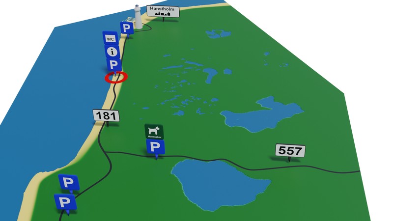
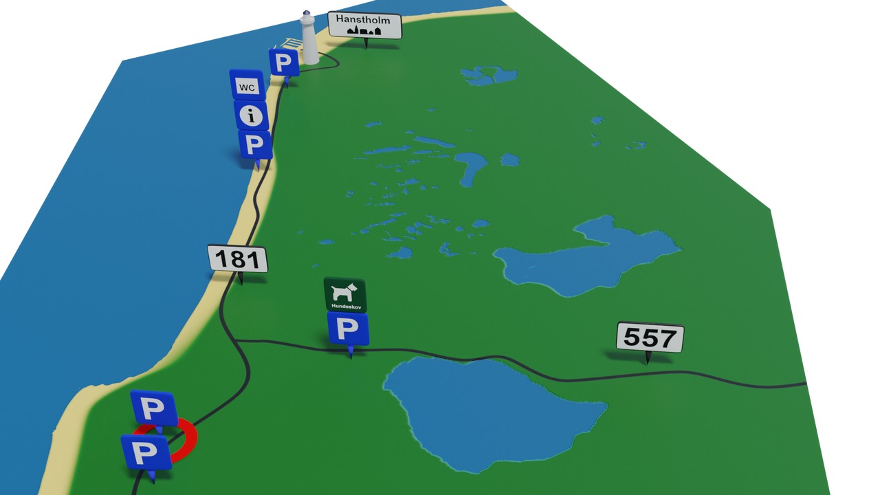
From Hanstholm in the north down to the ferry terminal at the end of Agger Tange, there are a long series of parking areas. Most are simple pull-off spots along the road, but there are also several dedicated parking lots, several of which have toilets.
Here we have made a brief overview of the best places to park. We have selected them based on parameters such as whether there are toilets, views, hiking trails, and cycling routes. Regarding toilets, you should be prepared that they are sometimes out of order.
The spots are sorted from north to south.
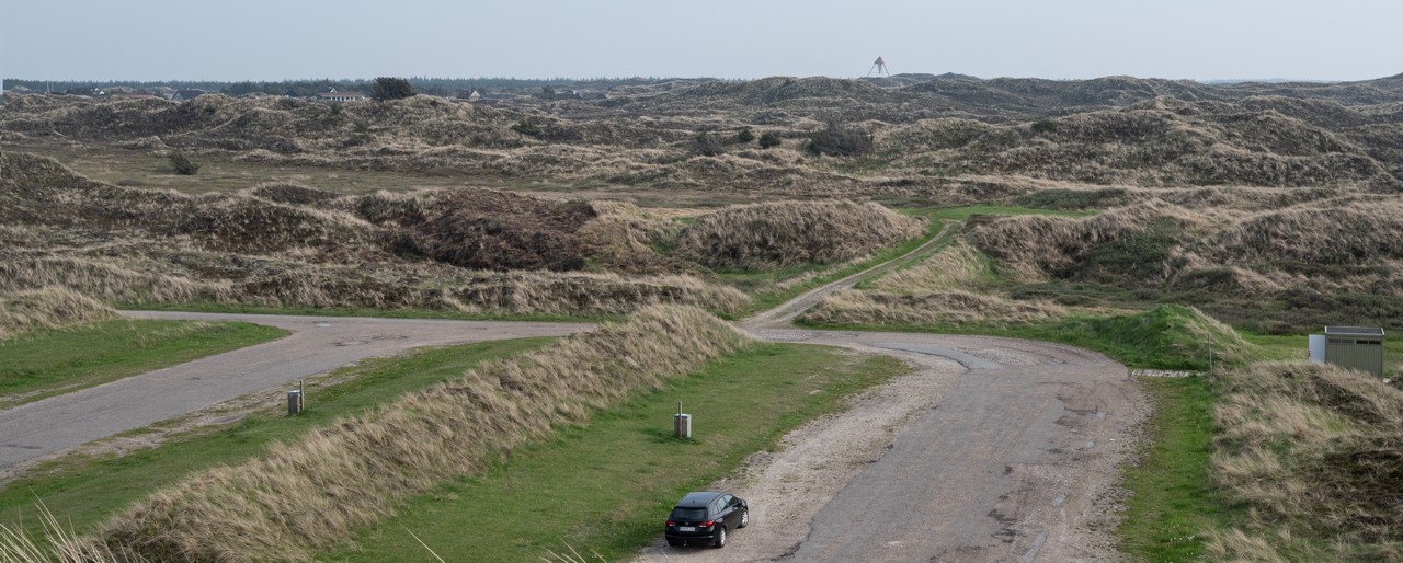
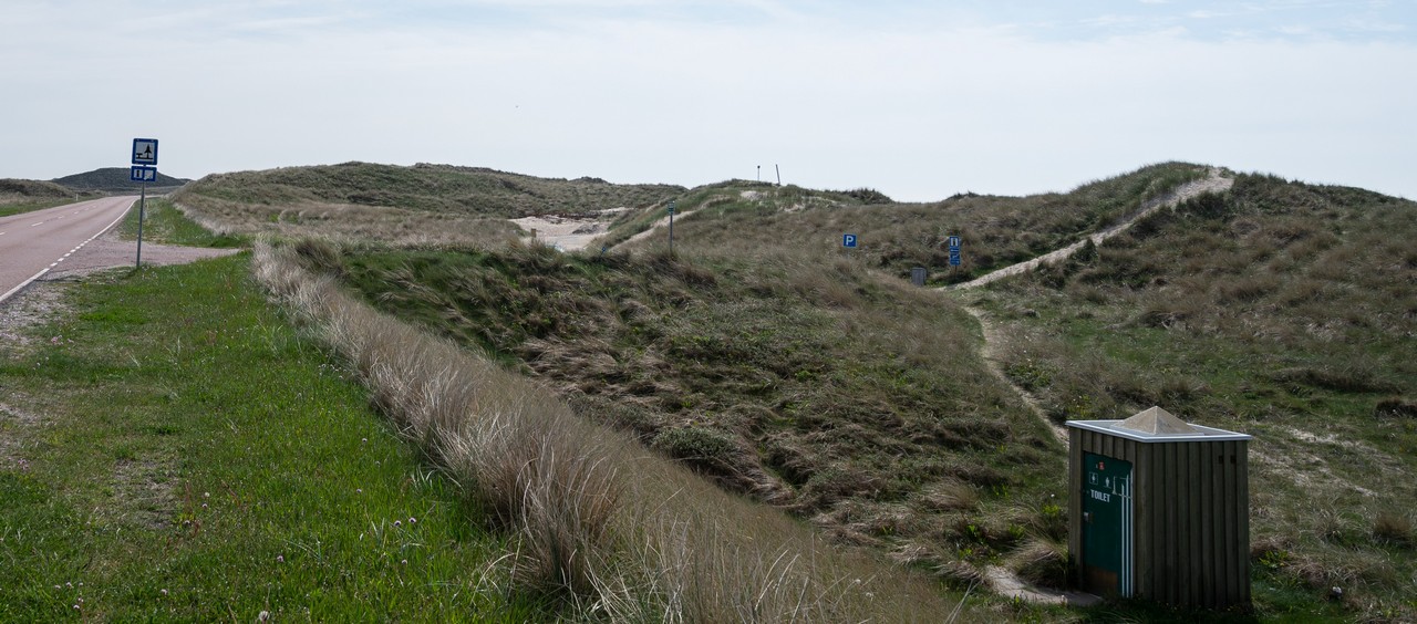
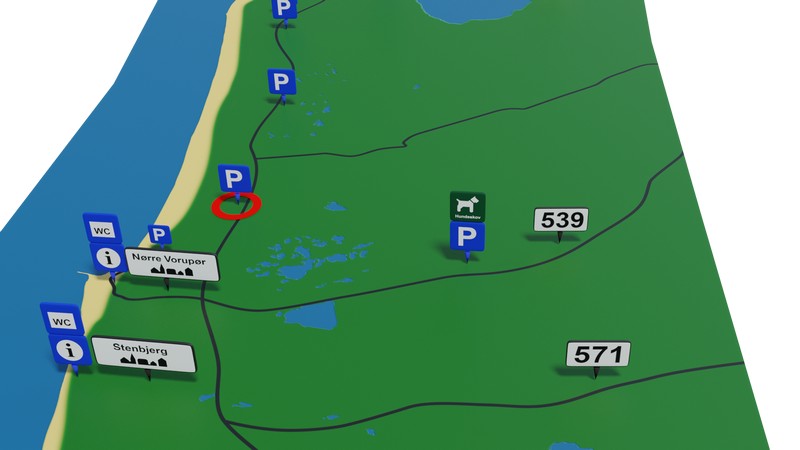
This parking lot is located by the coastal road midway between Hanstholm and Klitmøller. It is the first larger parking lot when heading south from Hanstholm.
The parking lot is easy to find when coming from the north, as there is signage both 300 meters before and at the entrance itself, as shown in the picture below. If you are coming from the south, there is no signage, but the lot is still easily recognizable.
| Facilities | |
|---|---|
| Toilet | Temporarily closed, June 2021 |
| Access to water | 50m |
| Hiking routes | Green: 640m. Yellow: 3.4km |
| Cycling routes | Cycling Route 1 (West Coast Route) |
| Tables and benches | 3 pcs |
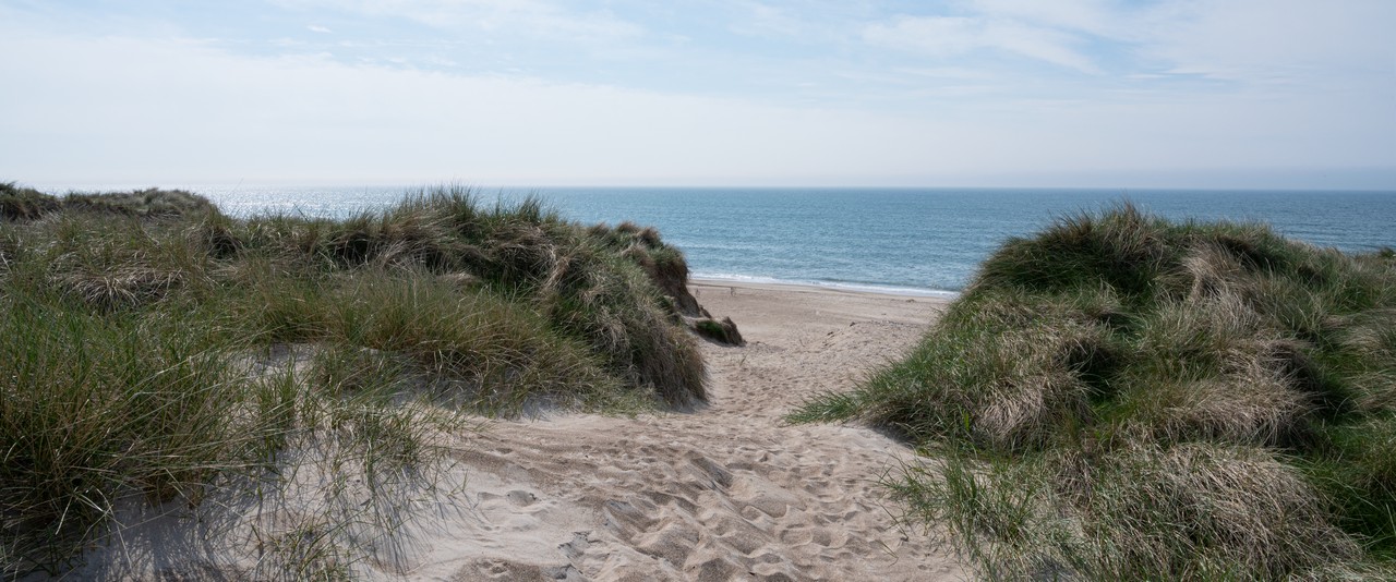
One of the special things about this parking lot is the easy access to the water. You can't see it from the road, as there are some small hills between the parking lot and the water, but you just have to walk a few steps up the hill, and then you see the water as shown below.
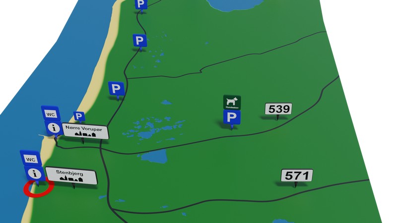
This is a larger gravel parking lot with toilets, well hidden off the road among the trees. The entrance itself can be hard to see, but if you miss it when coming from the north, you can take the next road to the right, which leads down to the campsite.
There are no actual hiking trails at this parking lot, but Cycling Route 1 (West Coast Route) passes close by. The toilet facilities are good here and there are separate toilets for women and men. There are several tables and benches, which are placed among the trees. img src="/img/natur/nationalpark_thy_p_klitmoeller_wc.jpg" alt="Picture of the parking lot at Klitmøller" class="kgm_gen_center">
| Facilities | |
|---|---|
| Toilet | Good facilities. Separate for women and men |
| Cycling routes | Cycling Route 1 (West Coast Route) |
| Tables and benches | 3 pcs |
In Tvorup dune plantation there are 6 parking lots, two of which are located on Kystvejen (181), and this parking lot is the northernmost of these.
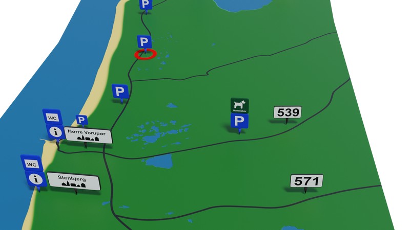
The lot has a single hiking route of 3.5 km in addition to the West Coast Trail and North Sea Trail, which also pass by here. The West Coast Trail is a 100 km hiking route from Bulbjerg to Agger, and the North Sea Trail goes from Mariager to Agger and is over 400 km. These are joined by Cycling Route 1 (West Coast Route), which is a 560 km cycling route from Rudbøl to Skagen.
| Facilities | |
|---|---|
| Hiking routes | Yellow: 3.5km. North Sea Trail and West Coast Trail also pass by. |
| Cycling routes | Cycling Route 1 (West Coast Route) |
| Tables and benches | 2 pcs |
This is the southern parking lot of the two Tvorup lots on 181.
The parking lot offers a single hiking route of 5 km, which it shares with the Bøgsted Rende parking lot. As with Tvorup North, you might consider the Bøgsted Rende parking lot instead if you are out hiking, as it has three hiking routes.
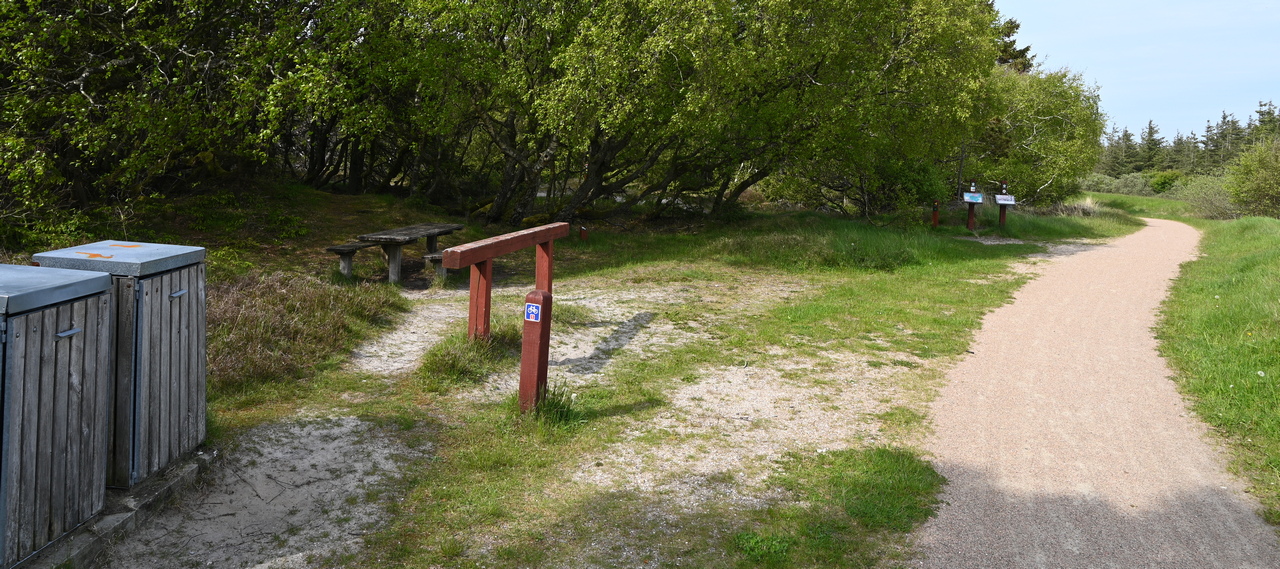
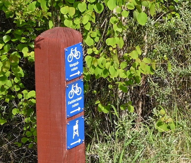
On the other hand, there are a total of 4 cycling routes passing by the parking lot. Cycling Route 1 (West Coast Route), 411 (Panorama Route), Vangsåruten, and Faddersbølruten all pass by here. Cycling Route 1 and 411 both run on the same side of the road as the parking lot, while the other two cross the road.
| Facilities | |
|---|---|
| Hiking routes | Red: 5km. North Sea Trail and West Coast Trail also pass by. |
| Cycling routes | Cycling Route 1 (West Coast Route), 411 (Panorama Route), Vangsåruten and Faddersbølruten |
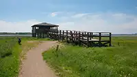
| Bird tower | Via the trail on the opposite side of the road |
| Tables and benches | 3 pcs |

| Facilities | |
|---|---|
| Access to water | 100 meters |
| Toilet | Located at the parking lot |